|
Journal 5/31/2005
| We started off in Amarillo, having
gotten a few lightning bolts on
film the night before. A quick check of the
SPC forecast
that am had
the Panhandle of Texas in the Slight Risk for Severe weather. At the time
only a 5% chance tornado oval was on the map. I was leaning
towards Lubbock, but was going by the forecast so we agreed to push to
Lamesa, Texas and check the
radar and SPC update.
Heading towards Lamesa, we were treated by nice puffy cumulus clouds,
a sure deception of what was to come just a few hours later. A few
brief dust devils caught our eye as we headed south.
|
| At about 3:30 we were on the internet
and Carrie called with the
latest weather updates. Having chased several storms with me in the past she told us that we should have stayed in the
North. AH!!!! I
wish she could have given us her thoughts that morning, but she was in college at the time. Two
super-cells had just gone through
Amarillo sending off sirens and they were moving due South. Carrie and I discussed the
possibility of meeting them as they were coming in. I was looking at radar at this point and near Clovis NM was the tiniest little blip that popped onto the
radar
loop. it was too early to see movement or the chances of it building, but both Carrie and I agreed there was something making us focus on it. So we
decided to keep a close eye on it for now, as we would need to head North to intersect it anyways. In addition we noticed that the
SPC
tornado chance area had expanded. |
| We got in the car and headed North through Lubbock on Hwy 87/I27. On
the other side, I was seeing the two large cells North. It was about 5pm and Carrie said that the two cells out of Amarillo were going to hit Plainview and that the Clovis storm was racing East to meet with them.
|
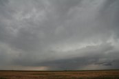
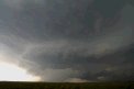
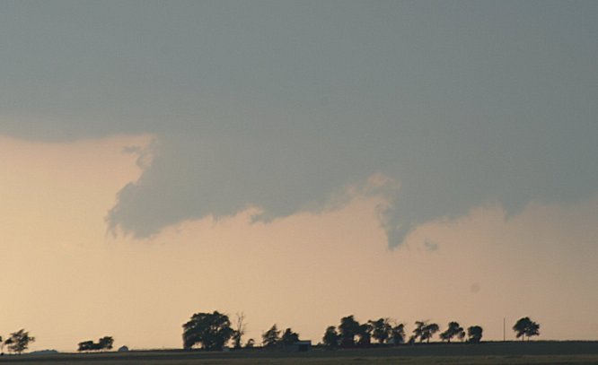
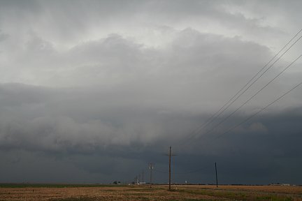
| We continued North and at about 5:30 a wall cloud to the West was
impressing me, so we shifted our chase to the Clovis storm (having originated in Clovis). This trek took us near the town of Hale
Center.
|
|
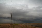
We made another stop at about 6:25pm, bit north on FM179. The two cells originally out of
Amarillo formed a great gust front. At this point the wall cloud was looking
a bit weakened. We grabbed a few pictures at this location and decided to
stop behind this other vehicle of probable storm chasers. We were right, the guys were from Colorado. The gust started to come in and I yelled for Mark to
get back to the car (about 6:40pm). He did just before a gust of strong wind hit
us and both the other storm chasers and
us took off heading South on 179.
|
|
|
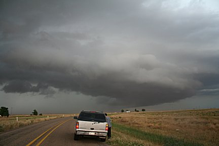
We continued on Hwy 179W for quite a bit then turned onto Hwy 84. I was
getting eager to look at the storms, but the chasers wouldn't slow down. They
had the computers to go by, but I'm use to chasing without computers and I
was dying to really SEE what was going on to make my own judgments as I have
in the past.
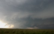
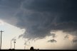
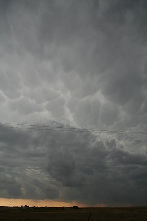
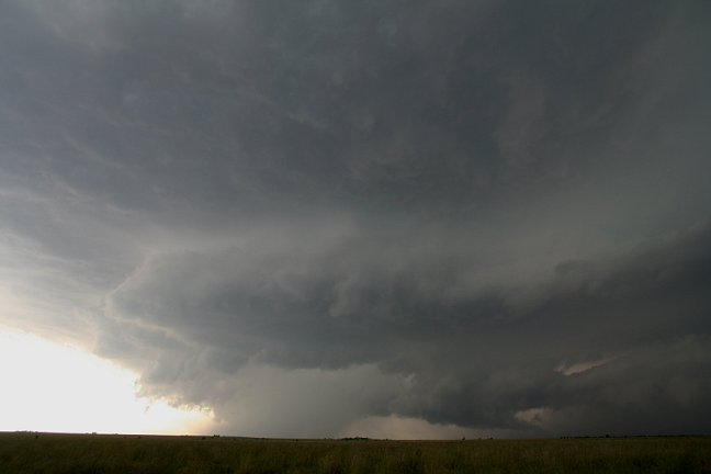
At about 7:10pm, we pulled onto FM2130 heading South and I thought something was
weird with my tires. Playing it safe and seeing it as a sign to pull over, we
stopped on FM2130. I checked the tires really quick, everything was fine so
it had to be the road. No problem either as we were looking at the wall cloud
in all its glory. I'm so glad we stopped. Just North of us, we realized was
the F5 Safari's Tour.
|
|
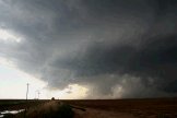
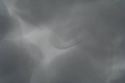
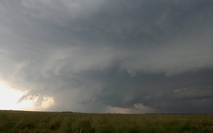
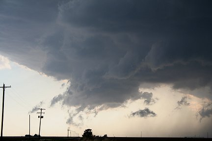
We got some pictures and pea-sized hail began to
fall. We went a few minutes down the road to escape the light rain and hail
and then stopped again. We pulled behind one or two cars and began to video
and photograph the ever impressive storm and wall cloud. Moments later a we
found ourselves in a Storm chaser convergence with 15 cars.
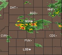
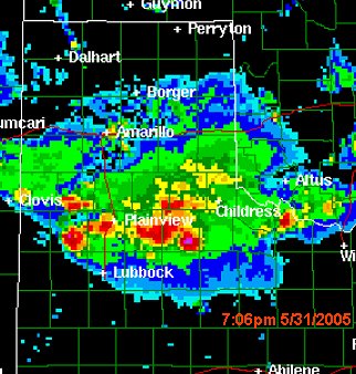
See
7:06pm Radar
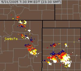
See
lightning data at 7:30pm |
|

|
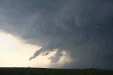
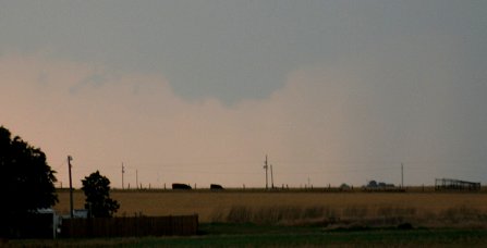
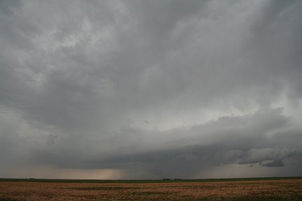
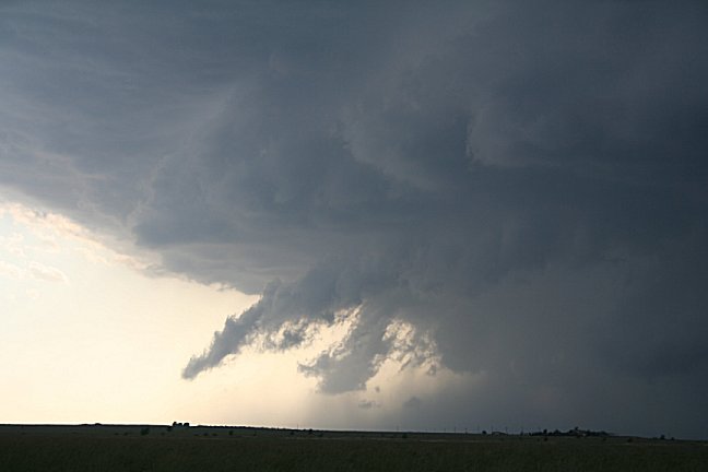
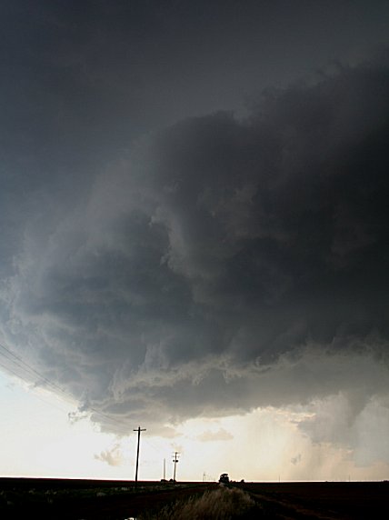
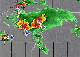
At 7:17 the wall cloud was growing more impressive with possible weak rotation (radar
summary). The
gust front and hail cores were still easily detectable. Had
We were there a few minutes while I was getting some current conditions from
Joe Lawton on the storms around us and their movement. I saw the gust front continue
to advance and finally told Joe I had to go. I yelled at Mark, in the already
brisk wind, to get in the car. A moment later a blast of strong wind hit us. I
saw Mark's camcorder get knocked off of the cars top. I didn't see until
after we were pulling out to escape that the street/road sign that had been
right there with us was ripped from the ground and moved a few feet where it
was laying flat.
|
Continued on page 2
(some of my favorite photos!)
|


